Published towns:
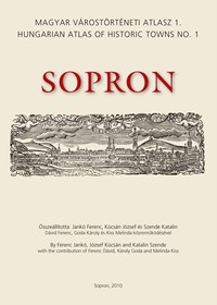 |
Sopronby Ferenc Jankó, József Kücsán and Katalin Szende; with the contribution of Ferenc Dávid, Károly Goda és MelindaKiss Cartography: Péter Banyó, Ferenc Jankó, József Kücsán Sopron: Sopron Archives of Győr-Moson-Sopron County, 2010. ISBN: 978-963-8327-32-1 |
Contents
Table of Contents
Preface
The Historical Topography of Sopron
Commentaries on the Plates
Historical Topographical Gazetteer
Bibliography
Plates (maps and views)
A. General maps
A.1 Base map drawn after the cadastral map of 1856, 1:2500
A.2 Sopron and its surroundings, 1:50 000
A.3 Topographical development of Sopron, 1:5000
A.4 Plan of the interior part of Sopron, c. 1900-1910, 1:5000
A.5 Topographical map of Sopron, 2005, 1:5000
A.6 Aerial photography of the centre of Sopron, 2005
B. Plates of thematic maps
B.1 Middle Ages and the Early Modern period
B.2 The eighteenth century
B.3 Early nineteenth century I
B.4 Early nineteenth century II
B.5 Buildings of Sopron in the nineteenth and twentieth centuries I
B.6 Buildings of Sopron in the nineteenth and twentieth centuries II
C. Reproductions of maps and views
C.1 Historic reconstructions
C.2 The oldest surveys of the centre of Sopron
C.3 Views of Sopron from the Lővér hills
C.4 Views of Sopron from the Kurucdomb
C.5 Views of Sopron in the middle of the nineteenth century
C.6 Surveys of sites in Sopron from the eighteenth century
C.7 Surveys of the Front Gate and its surroundings
C.8 The centre of Sopron, 1831
C.9 Order of market stalls at the annual fair, 1881
C.10 Sopron and its surroundings, 1802
C.11 Built-up areas outside the walls of the suburb, c.1750-1800
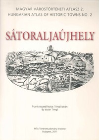 |
Sátoraljaújhelyby: István Tringli Cartography: Firbás Térkép Stúdió, Béla Nagy Budapest: HAS Institute of History, 2011. ISBN:978-963-9627-44-4 |
Contents
Table of Contents
Preface
The Historical Topography of Sátoraljaújhely
Historical Topography Gazetteer
Bibliography
Plates (maps and views)
A.1 Sátoraljaújhely in 1866 1:2500
A.2 The surroundings of the inner area of Sátoraljaújhely in 1876
A.3 The inner area of Sátoraljaújhely in 1883
A.4.1 The surroundings of Sátoraljaújhely on the first military survey (1763-1785)
A.4.2 The surroundings of Sátoraljaújhely on the second military survey (1806-1869)
A.5.1.The surroundings of Sátoraljaújhely in 1767
A.5.2 The surroundings of Sátoraljaújhely in 1901
A.6.1. Map of Zemplén county from 1804
A.6.2. The surroundings of Sátoraljaújhely 1880
A.7 Aerial view of Sátoraljaújhely 2005
A.8.1 Draft map of Sátoraljaújhely, comital town 1938
A.8.2 Map of Sátoraljaújhely 1968
B.1.1 Sátoraljaújhely at the end of Middle Ages 1:5000
B.1.2 Sátoraljaújhely in the middle of the 17th century 1:5000
B.2.1 Sátoraljaújhely at the end of the 18th century 1:5000
B.2.2 The so-called szerek (town districts) in modern Sátoraljaújhely 1:5000
C.1.1 Drawings of the plots measured out for the Calvinist church 1783.
C.1.2 The surroundings of the Roman Catholic church 1801.
C.2.1 Plan of the surroundings of the Casino 1836.
C.2.2 Plan of the streets of Sátoraljaújhely to be paved around 1844
C.3.1 Gusztáv Keleti: The Sátor hill and the Castle hill, 1867
C.3.2 The surroundings of the Roman Catholic church in 1904
 |
SzegedEditor: László Blazovich; with the contribution of Judit Balia-Nagy, Ferenc Horváth, Gábor Kelemen, Mátyás Kratochwill, Zsolt Máté, Anna Szemerey, Péterné Szerdahelyi and Máté Takács Cartography: Ida Erdélyi, Gábor Kelemen, Mátyás Kratochwill, Zsolt Máté, Anna Szemerey, Máté Takács Szeged: Csongrád County Local History Society, 2014. ISBN: 978-963-08-9999-4 |
Contents
Table of Contents
Preface
The Historical Topography of Szeged
Historical-topographical Gazetteer
Bibliography and abbreviations
A. General Maps
A.1.1 Base map drawn after the cadastral survey of 1841-44, inner area, 1:2500
A.1.2 Base map drawn after the cadastral survey of 1841-44, wider area
A.2.1 Szeged and its surroundings in the military survey I, 1:50 000
A.2.2 Szeged and its surroundings in the military survey II, 1:50 000
A.3.1 Szeged in the 11–14th centuries, 1:50 000
A.3.2 The situation map drawn after the tithe record of 1522, 1:10 000
A.3.3 The situation map drawn after the city map of 1713, 1:10 000
A.3.4 Szeged and Ujszeged at the end of the 18th century, 1:10 000
A.3.5 Szeged’s phase map of 1841-44/1850, 1:10 000
A.3.6 The extension of the flood on 11th June 1879, 1:10 000
A.3.7 The stratum map of Szeged’s inner town in 1879
A.3.8 Szeged’s street grid in 1883, 1:10 000
A.3.9 Szeged’s phase map of 1841-44/2010, 1:10 000
A.4.1 Szeged’s topographical map, 2010, 1:10 000
A.5.1 Aerial photograph of the city centre, 1:5000
B. Thematic maps
B.1 Szeged’s streets in 1522
B.2 Socio-topographical map of Szeged, 16th century
B.3 Szeged’s altitude after the Great Flood, 1879
B.4 Built-in and used lands, 1900/2010
B.5 Residential areas of one-family houses, 1918/1945
B.6 Changes of land use, 1900/2010
B.7 Closed down and operating industrial plants, 1990/2010
B.8 Gap-site constructions in the downtown area, 1945/2010
B.9 The architectural character of the residential and mixed areas, 2010
B.10 The protected architectural heritage of the historic town, 2010
C. Reproductions, maps and views
C.1.1 The Szeged Castle in 1552
C.1.2 The Szeged Castle and the Palank in 1695
C.1.3 The Szeged Castle and the Palank at the end of the 17th century
C.1.4 Szeged’s town map of 1713
C.1.5 The survey of the Szeged Castle, 1751
C.1.6 The map of Szeged’s outskirts 1841-1844/2014, 1:96 000
C.1.7 The situation plan of Szeged, 1850
C.1.8 The street grid of Szeged’s inner town, 1879, 1:10 000
C.2.1 Szeged and its wider environs, 1834
C.2.2 The topographical map of Szeged designed for defence, 1848
C.2.3 Szeged City and the Tape meadow, 1907, 1:96 000
C.3.1 The road system of the Great Plain in the 14-16th centuries
C.3.2 The Szeged Castle and its environs, ca. 1775
C.4.1 The Szeged Castle and the Palank, 1709
C.4.2 Szeged in 1799
C.4.3 The Szeged’s schools, 1820
C.4.4 Szeged viewed from the Banat, ca. 1830
C.4.5 The railway bridge on the Tisza, 1858
C.4.6 Life on the Tisza with the railway bridge in the 1870s
C.4.7 Photograph of the flood, 1880
C.4.8 Flood photograph with Upper Town, 1879
C.4.9 Flood photograph about Upper Town, 1879
C.4.10 The visit of Emperor Franz Joseph I in Szeged, 1879
C.4.11 The Church Square from the south, 1880
C.4.12 The Lower Town church and monastery, 1881
C. 4.13 The towered school, 1800
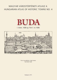 |
Buda Part I to 1686by András Végh Cartography: Zsuzsanna Kuczogi, Béla Nagy, Anna Szemerey Budapest: Budapest History Museum, Pázmány Péter Catholic University Faculty of Humanities and Social Sciences, Department of Archaeology, Archaeolingua Foundation, 2015. ISBN: 978-615-5341-22-9 |
Contents
Table of Contents
Preface
The Historical Topography of Buda (1241–1541–1686)
Historical-topographical Gazetteer
Bibliography
Contents of Plates
A. General maps
A.1.1 Base map drawn after the cadastral map of 1873, 1:2500
A.2.1 Buda and its surroundings, First Military Survey, 1:50 000
A.2.2 Buda and its surroundings, Second Military Survey, 1:50 000
A.3.1 Topographical development of Buda: 1. The area of Buda before its foundation (Roman antecedents), 1:5000
A.3.2 Topographical development of Buda: 2. Buda after its foundation, end of 13th c. – early 14th c., 1:5000
A.3.3 Topographical development of Buda: 3. Buda in the late Middle Ages, early 16th c., 1:5000
A.3.4 Topographical development of Buda: 4. Buda in the Ottoman Period, last quarter of the 17th c. up to 1686, 1:5000
A.4.1 Topographical map of Buda, 2005, 1:10 000
A.5.1 Aerial photograph of the centre of Buda, 2005, 1:10 000
B. Plates of thematic maps
B.1.1 Ethnic distribution in the Castle District, 14th century–early 15th century
B.1.2 Ethnic distribution in the Castle District, late 15th century–early 16th century
B.1.3 Properties owned by judges and councillors in the Castle District 13th–14th centuries
B.1.4 Properties owned by bishoprics and cathedral chapters in the Castle District
B.2.1 Properties of magnates in the Castle District, 1241–1410
B.2.2 Properties of magnates in the Castle District, 1500–1526
B.2.3 The foreground of the Royal Palace, 13th–14th centuries
B.2.4 The foreground of the Royal Palace, early 16th century
C. Reproductions of maps and views
C.1.1 View of Buda from west in the World Chronicle of Hartmann Schedel, 1493
C.2.1 Johann Siebmacher, Views of Buda from west and east, 1598, or 1601
C.3.1 Erhard Schön, The siege of Buda (detail), view from west, 1541
C.3.2 Virgil Solis, The siege of Pest with the view of Buda from east, 1542
C.3.3 Unknown master, Reception of the imperial envoy in Buda, view from east, about 1600
C.4.1 Joseph Hauӱ, Map of Buda Castle with the size of the lots on their façades, 1687
C.5.1 Nicolas Marcel de La Vigne, Map of Buda and Pest (detail), 1686
C.5.2 H. Bredekow, Map of Buda and Pest, 1686
C.6.1 Ludwig Nicolaus von Hallart and Michael Wening, Series of views of Buda from the four cardinal directions, north, 1684
C.6.2 Ludwig Nicolaus von Hallart and Michael Wening, Series of views of Buda from the four cardinal directions, south, 1684
C.6.3 Ludwig Nicolaus von Hallart and Michael Wening, Series of views of Buda from the four cardinal directions, east, 1684
C.6.4 Ludwig Nicolaus von Hallart and Michael Wening, Series of views of Buda from the four cardinal directions, west and east, 1684
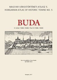 |
Buda Part II (1686-1848)Edited by: Magdolna Szilágyi Cartography: Imre Faragó, Béla Nagy, Anna Szemerey, Katalin Tolnai Budapest: Budapest City Archives, HAS RCH Institute of History, 2017. ISBN: 978-615-5635-07-6, ISSN: 2498-7166 |
Contents
Table of Contents
Preface
The Historical-topography of Buda from 1686 to 1848
Historical-topographical Gazetteer
Bibliography
Contents of the Plates
A. General maps
A.1.1 Base map drawn after the cadastral map of 1873 (BFL XV. 16.a 201/9), 1:2 500
A.2.1 Detail of the First Military Survey, 1782-1785
A.2.2 The surroundings of Buda around 1785
A.2.3 Overview map of Buda, late 18th century
A.2.4 Buda and its surroundings, 1836
A.3.1 Buda at the turn of the 17th and 18th centuries
A.3.2 Buda in the Reform Era (c. 1830)
A.4.1 Topographical map of Buda, 2005, 1:10 000
A.5.1 Aerial photograph of the centre of Buda, 2005
B. Plates of thematic maps
B.1.1 Public facilities in Buda in the end of the 18th century
B.2.1.a The centres of Tabán and Víziváros in 1818 based on the 1818-1819 census of the non-noble population
B.2.1b House plots by blocks in the centres of Tabán and Víziváros in 1818 based on the 1818-1819 census of the non-noble population
B.2.1c The number of families by blocks in the centres of Tabán and Víziváros in 1818 based on the 1818-1819 census of the non-noble population
B.2.1d The number of inhabitants by blocks in the centres of Tabán and Víziváros in 1818 based on the 1818-1819 census of the non-noble population
B.2.1e Religious denominations by families in the centres of Tabán and Víziváros in 1818 based on the 1818-1819 census of the non-noble population
B.2.2 The distribution of the individual occupations by the heads of families in the centres of Tabán and Víziváros based on the 1818-1819 census of the non-noble population
C. Reproductions of maps and views
C.1.1 Joseph Hauy: Plan de la ville et chateav de Bvde, 1687
C.1.2 Nicolas Marcel de La Vigne: Budae ac Pesti ichonographica descriptio, 1686, secunda tabula
C.1.3 Map of fortifications in the Castle District and its surroundings, 1749
C.1.4 Overview map of Víziváros, 1786-1792
C.1.5 Site map of the Castle, 1786-1794
C.1.6 Overview map of Újlak and Országút, 1802
C.1.7 Plan of the buttress in Halászváros, 1812
C.1.8 Detailed map of the Castle, Rácváros, Krisztinaváros and Víziváros, 1824
C.1.9 Hydrographical map of Pest, Buda and Óbuda, 1833
C.1.10 Map and view of Buda with the pictures of its sights, around 1837 (Carl P. Vasquez)
C.2.1 Frans Geffels: The siege of Buda, 1686
C.2.2 Alexander Glässer (after the drawing of Friedrich Bernhard Werner): View of Buda, 1732
C.2.3 Josef and Peter Schaffer: View of Buda and Pest, 1787
C.2.4 András Petrich: Floodlight of Buda and Pest, 24 October 1814
C.2.5 Antal Fülöp Richter (after András Petrich): Buda and Pest viewed from Gellért Hill, 1818
C.2.6 Jacob Hyrtl: View of Buda and Pest, 1832
C.2.7 Franz Xaver Sandmann: Buda and Pest viewed from Gellért Hill, 1848
C.3.1 Andreas and Josef Schmutzer (after Sámuel Mikoviny): View of Buda, 1737
C.3.2 Johann Christian Leopold (after Friedrich Bernhard Werner): Buda and Pest, viewed from the east
 |
Kőszegby István Bariska, with the contribution of Lilla B. Benkhard, Péter Ivicsics, Viktória Kovács, Klára Mentényi, Imre Söptei, Magdolna Szilágyi Edited by: Magdolna Szilágyi Cartography: Imre Faragó, Béla Nagy, Anna Szemerey, Katalin Tolnai Budapest: HAS RCH Institute of History, 2018. ISBN: 978-963-419-130-1, ISSN: 2498-7166 |
Contents
Table of Contents
Preface
The Historical-topography of Kőszeg
Historical-topographical Gazetteer
Bibliography
Contents of the Plates
A. General maps
A.1.1 Kőszeg and its surroundings. Base map drawn after the cadastral map of 1857 (MNL OL S 78 262), 1:2500
A.2.1 Kőszeg and its surroundings on the First Military Survey, 1784, 1:50 000
A.2.2 Kőszeg and its surroundings on the Second Military Survey, 1844–1845, 1:50 000
A.3.1 Inner town of Kőszeg in the second half of the 13th century, 1:2500
A.3.2 Inner town of Kőszeg in the early 15th century, 1:2500
A.3.3 Kőszeg in the 1300s, 1:10 000
A.3.4 Kőszeg in the 1400s, 1:10 000
A.3.5 Kőszeg in the 1500s, 1:10 000
A.3.6 Kőszeg in the 1600s, 1:10 000
A.3.7 Kőszeg around 1750, 1:10 000
A.3.8 Kőszeg around 1850, 1:10 000
A.3.9 Kőszeg around 2000, 1:10 000
A.4.1 Map of the interior part of Kőszeg, János Tóvári, 1927, 1:10 000
A.4.2 Survey plan of the interior part of Kőszeg, 1972, 1:10 000
A.4.3 Manó Kogutowicz, The map of Kőszeg free royal town, 1898
A.5.1 Topographical map of Kőszeg, 2001, 1:10 000
A.5.2 Topographical map of Kőszegfalva, 2001, 1:10 000
A.6.1 Aerial photograph of Kőszeg, 2010
B. Plates of thematic maps
B.1.1 The urban elite by religious denominations in the inner town, 1660–1666, 1:2500
B.1.2 The urban elite by religious denominations in the inner town, 1697–1728, 1:2500
B.1.3 Military taxes levied on houses in the inner town in 1725, 1:2500
B.1.4 The properties of citizens and ennobled citizens by religious denominations, 1728–1767, 1:2500
B.1.5 High and lesser nobles, and ennobled citizens in the inner town, 1775–1780, 1:2500
B.1.6 The houses of town judges in the inner town of Kőszeg, 16th–17th centuries, 1:2500
B.1.7 The houses of town judges and mayors in the inner town, 18th–19th centuries, 1:2500
B.2.1 Mills in Kőszeg along the two branches of the Gyöngyös Stream, 1570–1950, 1:10 000
B.2.2 Inns and restaurants in Kőszeg along the longitudinal axis of the town, 16th–20th centuries, 1:10 000
B.2.3 Ecclesiastical and lay institutions established in Kőszeg before 1850, 1:10 000
B.2.4 Ecclesiastical and lay institutions established in Kőszeg, 1850–1950, 1:10 000
B.3.1 Kőszeg vineyards on Magyar-hegy (Ungarisches Gebirg) and Német-hegy (Deutches Gebirg), 1:5000
C. Reproductions of maps and views
C.1.1 Site plan of the surroundings of Kőszeg with the Gyöngyös Stream, Michael Hechinger, 1815
C.1.2 Map of Kőszeg with the network of postal ways and trade roads in the surroundings of the town, Karl Schuberth, 1819
C.1.3.1 Site plan of the Gyöngyös Stream Tab. I, Karl Schuberth, 1826
C.1.3.2 Site plan of the Gyöngyös Stream Tab. II, Karl Schuberth, 1826
C.1.4 Cadastral map of Kőszeg, Zsigmond Kovatsits, 1838–1839
C.1.5 Kőszeg Mountains, hiking map, unknown author, 1942
C.2.1 View of Kőszeg from west, votive painting by Bálint Fancz, 1746
C.3.1 View of Kőszeg from east, engraving by Karl Schuberth, 1808
 |
Kecskemétby Edit Sárosi, with the contribution of Magdolna Szilágyi and Zsolt Szilágyi Historical-topographical gazetteer by Edit Sárosi, with the contribution of György Belicza Edited by: Magdolna Szilágyi Cartography: Imre Faragó, Béla Nagy, Anna Szemerey Budapest–Kecskenét: Budapest City Archives, HAS RCH Institute of History, Katona József Museum of Kecskemét 2018. ISBN: 978-963-416-152-3, ISSN: 2498-7166 |
Contents
Table of Contents
Preface
The Historical-topography of Kecskemét
Historical-topographical Gazetteer
Bibliography
Contents of the Plates
A. General maps
A.1.1 Kecskemét. Map drawn after the cadastral map of 1869, 1:2500
A.2.1 Kecskemét and its surroundings on the First Military Survey, 1:50 000
A.2.2 Kecskemét and its surroundings on the Second Military Survey, 1:50 000
A.3.1 Topographical development of Kecskemét 1: Kecskemét in the late Middle Ages, 1:10 000
A.3.2 Topographical development of Kecskemét 2: Kecskemét in the late 17th century, 1:10 000
A.3.3 Topographical development of Kecskemét 3: Kecskemét in the late 18th century, 1:10 000
A.4.1 Map of the town of Kecskemét with municipal rights, 1905, 1:10 000
A.4.2 Overview map of the town of Kecskemét with municipal rights, 1933, 1:10 000
A.5.1 Topographical map of Kecskemét, 2002, 1:10 000
A.5.2 Aerial photograph of Kecskemét, 2002
B. Plates of thematic maps
B.1.1 The socio-economic use of space by fruit merchants at Kecskemét, 1922–1938
B.1.2 The occupational socio-topography of wage earners and the elite at Kecskemét by districts, 1930
B.1.3 The occupational socio-topography of the elite, 1935
B.1.4 The outskirts of Kecskemét (A), and its region within a distance of a half-day’s walk (B) in the 1930s
C. Reproductions of maps and views
C.1.1 View of Kecskemét on a journeyman’s book, 1816
C.1.2 View of Kecskemét on the liberty letter of the millers’ guild issued in 1843
C.1.3 View of Kecskemét on the charter of the weavers’ guild, 1840
C.1.4 View of Kecskemét on the charter of the curriers’ guild issued in 1843
C.2.1 Kecskemét in the early 18th century
C.2.2 Old map of Kecskemét, 1923
C.3.1 Survey of Kecskemét, around 1740
C.3.2 Survey of the third tenth of Kecskemét, around 1790
C.3.3 Destruction at Kecskemét caused by the fire on 2 April 1819
C.4.1 Planum hoc fine regulationis nundiarum in Privilegiato Oppido Ketskemét instituendo, elaboratum est, 1792
C.4.2 Map of the Vásárállás (‘Fairground’), around 1800
C.4.3 The surroundings of Csongrádi and Mezei Gates, around 1800
C.4.4 The survey of Vásárállás (‘Fairground’), Serház (‘Beerhouse’), Kecskeházi Inn, 1806
C.5.1 Public pastures of Kecskemét, around 1841
C.6.1 Dry mills in Kecskemét, 1857
C.6.2 Outline of pavements in Kecskemét, 1860
C.7.1 Kecskemét free royal town, 1879
C.7.2 Overview map of Kecskemét free royal town, 1885
C.8.1 Map of the outskirts of Kecskemét town with municipal rights, 1919
C.8.2 Map of Kecskemét town with municipal rights, 1948
C.9.1 Town map of Kecskemét, 1979
C.9.2 Town map of Kecskemét, 2015
 |
Pécsby Tamás Fedeles, with the contribution of Csilla Gáti, Gergely Kovaliczky, Erzsébet Nagy, Ferenc Jankó, Viktória Kovács, Éva Schmelczer-Pohánka, Balázs Sudár, Magdolna Szilágyi, and Zsolt Tóth Historical-topographical gazetteer by Tünde Árvai Tünde, with the contribution of the authors Cartography: Tünde Árvai, Béla Nagy Béla, Éva Schmelczer-Pohánka, Zsolt Tóth Budapest‒Pécs: RCH Institute of History, University of Pécs, 2021. ISBN: 978-963-416-243-8, ISSN: 2498-7166 |
Contents
Table of Contents
Preface
The Historical-topography of Pécs
Historical-topographical Gazetteer
Bibliography
Contents of the Plates
A. General maps
A.1.1 Base map drawn after the cadastral map of 1856, 1:2500
A.1.1a Base map drawn after the cadastral map of 1856 (detail, upper left), 1:2500
A.1.1b Base map drawn after the cadastral map of 1856 (detail, lower left), 1:2500
A.1.1c Base map drawn after the cadastral map of 1856 (detail, upper right), 1:2500
A.1.1d Base map drawn after the cadastral map of 1856 (detail, lower right), 1:2500
A.2.1 Detail of the First Military Survey (1783‒1784), rescaled to 1:50000
A.2.2 Detail of the Second Military Survey (1859), rescaled to 1:50000
A.3.1 Pécs 1009‒1242, 1:10000
A.3.2 Pécs 1242‒1543, 1:10000
A.3.3 Pécs during the Ottoman Era, 1543‒1686, 1:10000
A.4.1 The plan of Pécs free royal town, after Anton Duplatre (1777), drawn by Peter Maria v. Berks, 1817
A.4.2 The map of Pécs Free Royal Town, Lukrits Ignác, 1843
A.5.1 The topographical map of Pécs, 2005, 1:10000
A.6.1 Aerial view of the centre of Pécs, 2005, 1:5000
B. Plates of thematic maps
B.1.1 Prehistoric sites in the territory of the town and its surroundings: neolithic sites
B.1.2 Prehistoric sites in the territory of the town and its surroundings: Copper Age sites
B.1.3 Prehistoric sites in the territory of the town and its surroundings: Early Bronz Age sites
B.1.4 Prehistoric sites in the territory of the town and its surroundings: Middle Bronz Age sites
B.1.5 Prehistoric sites in the territory of the town and its surroundings: Late Bronz Age sites
B.1.6 Prehistoric sites in the territory of the town and its surroundings: Early Iron Age sites
B.1.7 Prehistoric sites in the territory of the town and its surroundings: Late Iron Age sites
B.2.1 Late Roman cemetery buildings in the northern cemetery of Sopianae
B.3.1 Avar period sites in the territory of the town and its surroundings
B.4.1 The Szigeti suburb in the eighteenth century, after Antal Fetter
B.4.2 Streets in Pécs in 1722
B.4.3 Streets in Pécs in 1842
B.5.1 Ecclesiastical topography of Pécs in the eighteenth and nineteenth centuries
B.6.1 The sites and relocation of educational institutions in Pécs in the eighteenth and nineteenth centuries
B.7.1 Craftsmen in the centre of Pécs (1828)
C. Reproductions of maps and views
C.1.1 Cella trichora II. The second three-apse building in the territory of the Late Roman northern cemetery at 10 Janus Pannonius Street (Rose Garden) (photo, plan, digital reconstruction)
C.1.2 The Late Roman pagan basilica of Sopianae (plan, digital reconstruction)
C.2.1-4 The vistas of Pécs in the Ottoman period
C.2.1 Leaflet by Anton Salomon Schmidtmayr representing and describing the 1664 siege of Pécs
C.2.2 The 1664 siege of Pécs, Lucas Schnitzer
C.2.3 The 1686 representation of Pécs, Giovanni Antonio Panceri
C.2.4 Ink drawing of the 1664 or 1686 siege of Pécs by an unknown author
C.3.1 1687 site plan by Joseph de Haůy French military engineer
C.3.2 The reconstruction of building plots and streets in Pécs after the 1722 land register. By József Madas, 1970
C.4.1 Layout, hydrographic and agricultural maps of the inner and outer parts of Pécs, Antonius Duplater, 1780
C.4.2 Mills and buildings along Stream Tettye, Franciscus Quits, around 1780
C.4.3 Site plan of the bishop's castle, Antonius Duplater, 1780
C.5.1 The 1763 view of Pécs on a copper cut by Joseph Hochrein
C.5.2 The 1863 view of Pécs on a copper cut by Joseph Hochrein
C.5.3 The 1799 view Pécs on a guild master's certificate
C.5.4 The 1799 view Pécs on a guild master's certificate
C.5.5 The 1802 view Pécs on a guild master's certificate, Joseph Kieler
C.5.6 The 1833 view Pécs on a guild master's certificate, Anton Mayrhofer
C.5.7 The 1783 view of Pécs from the south, Franciscus Fay, 1817
Ózd |
Town atlases in progress:
Győr. ed: Gábor Nemes
Miskolc. ed.: Éva Gyulai
Nyírbátor. ed.: Péter Németh
Ózd. ed.: Gábor Demeter
Óbuda. ed.: Katalin Simon, Magdolna Szilágyi
Pápa. ed.: István Hermann
Pest. ed.: Katalin Simon
Székesfehérvár. ed.: József Csurgai Horváth
Szekszárd. ed.: Márta Vizi
Szombathely. ed.: László Mayer
Vác. ed.: Márta Velladics

